Here's one thread from 2009 (link).
the Duck Hollow to Rankin Bridge trail ?
I tried to find an earlier thread but couldn't.
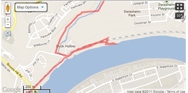
Today I went in search of the trail between Duck Hollow and the Rankin Bridge, which Google Maps depicts like this:
I don't think I was doing it right. All I could find was a (rough) path along the railroad tracks, and after I followed a few false leads I turned around and got out of there.
May I ask, is there a name for this trail?
Is the path along the tracks the current state of the trail, or is there something more to be found?
Thanks very much.
Cheers,
V.
I live on the hill/cliff right behind this "trail". Very rarely do I see people use this. Not sure where it dumps you off at in Rankin, but you can take duck hollow - nine mile run- Frick. Either way I wouldn't do it on my road bike!! I am curious though, any information would be great.
Google sometimes uses the same green line for official paved bike trails and for proposed future trails that currently require trespassing and often a tolerance for riding on challenging surfaces. This is one of the latter.
I think Google shows it because it's on the Steel Valley Trail Council's map as a future trail. They don't show a proposed name though.
That's the "trail" which you found out is not a trail at all but a rough pot holed dirt road that illegal pick up trucks who are either dumping or scavenging use. It turns into a slightly less rough road later on, but it's still not easily passable without a mountain bike.


